Fisherman Island
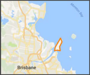
Co-ordinates: -27.374591, 153.176317
Access: By car- Port Drive.

Now home to the Port of Brisbane, the third largest port in Australia, Fisherman Island is located at the mouth of the Brisbane river. It was in 1971 that plans began to build the port on Fisherman Island with construction taking place between 1977 – 1980.
The areas around the port are constantly being dredged to ensure that the enormous container ships can safely get to the port despite nature constantly pushing back creating sandbanks around Fisherman Island and the port of Brisbane.
Next – Check out Lamb Island below


